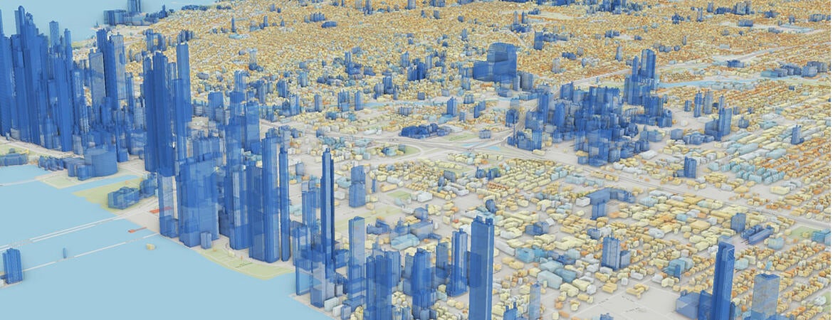
The reach of geographic information systems, or GIS, technology now goes well beyond our ability to find the fastest route to Los Angeles International Airport on a smartphone.
As each generation of cameras, satellites, and an array of remotely operated sensors gather increasingly huge volumes of location data, GIS advances allow us to visualize and use this information in previously unimaginable ways.

"It's just stuff that I could never even dream of 30 years ago as an undergraduate," said Tony Grubesic, director of UCR's Center for Geospatial Sciences and a professor in the School of Public Policy.
Consider:
• Wildlife officials in Florida now use GIS to track the presence of endangered sea turtles and know when and where to close beach locations so the turtles may lay their eggs without being disturbed and the hatchlings can more safely make their way to the sea.
• Farmers can determine in real time exactly where and how much water and fertilizer should be delivered in the field to produce optimal crop yields in the growing arena of precision agriculture.
• Plant pollen profiles can be mapped worldwide, allowing the U.S. military to find out where improvised explosive devices came from by examining the microscopic bits of pollen found in the devices.
• GIS systems have even found their way into the dentist's office. Scans of the insides of our mouths now create three-dimensional images showing the dentist exactly where work is needed.
The explosive growth of hundreds of such applications has put UCR's six-year-old Center for Geospatial Sciences, or CGS, in growth mode. Not only can graduates with GIS skills find jobs with GIS industry leaders, such as Esri, Google, Apple, FedEx, and Amazon – but they are also in exceptionally high demand for federal, state, and local government positions, said Grubesic, who joined UCR last year.
The center now offers six courses in GIS, with entry-level classes filling up quickly and the center looking to add more sections that attract students across traditional academic boundaries. The center recently received a $140,000 grant from the UC system to develop online GIS courses.
The CGS's role, however, goes well beyond instruction to help place students in what was a $7.85 billion industry in 2021 and is expected to triple by 2030. It is also a research center working to advance the technology.

Specifically, the center uses open-source software to develop analytical techniques for solving computationally intensive geospatial planning and policy problems. This work includes time and space prediction, context-aware computing, remote sensing, and vividly mapping these data.
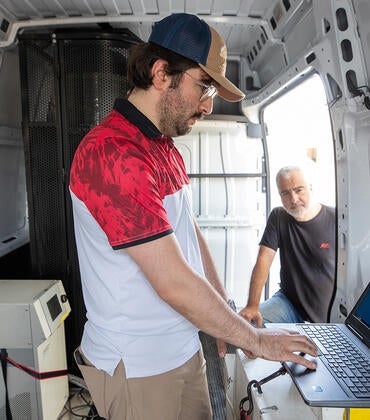
The center is further developing capabilities to better collect, fuse, and curate geospatial data gathered by next-generation sensors such as drones, mobile devices, and Light Detection and Ranging (LiDAR) technologies.
A transplant from the University of Texas at Austin, Grubesic brings a wealth of GIS experience to UCR. As an undergraduate, he began with a pencil and graph paper. While working on his master's degree, he also worked at Esri, where he wrote code and did other tasks to help develop early GIS programs used by government planners, among other early adaptors, in the 1990s.
Grubesic later found himself piloting drones to gather thousands of images to create sophisticated maps to illustrate various trends in urban landscapes.
"The future of urban informatics and GIS will be driven by AI and remote sensing technologies – the latter is a great way to collect hyperlocal data for spatial analysis," he said.
One use of drone-GIS fusion is identifying abandoned swimming pools where mosquitoes breed and spread the West Nile virus so these pools can be drained or treated.
"There is a growing demand for GIS professionals that understand the social and policy contexts of GIS, geoinformatics, and spatial reasoning," Grubesic said.
"This niche is where CGS and UCR can make their mark."