Three UCR engineering faculty members have received competitive grants from the National Science Foundation to develop technologies that could reshape how we travel, see our world, and interact with intelligent machines.
The Marlan and Rosemary Bourns College of Engineering scholars will receive more than a $1 million combined to make roads safer, mapping tools more accessible, and autonomous systems, such as self-driving cars and drones, more reliable and trustworthy.
“These grants reflect UC Riverside’s commitment to research that matters,” said Christopher Lynch, dean of the engineering school. “Our faculty are leading efforts that will help shape safer roads, smarter cities, and more sustainable environments.”
Here’s a closer look at the award-winning projects:
Breaking Communication Barriers for Remote Driving

While self-driving cars may handle many driving situations on their own, they still need human assistance in complex scenarios like navigating construction zones or accident scenes.
Making Autonomous Systems Smarter and Safer

As autonomous technologies like delivery drones, autonomous vehicles, and smart infrastructure become more common, ensuring they work together safely and reliably is a critical challenge.
With a $300,000 NSF award, Li is leading a project to make these “multi-agent systems” more resilient, adaptive, and trustworthy. His research will develop algorithms that can detect abnormal behavior, manage uncooperative or malfunctioning agents, and enable diverse machines or robots to coordinate effectively under real-world conditions.
The research has wide-ranging applications in transportation, disaster response, and infrastructure management, where reliable coordination among autonomous agents can improve public safety and efficiency. Beyond technical advances, the project emphasizes safety, fairness, and transparency in artificial intelligence, helping build public trust in future autonomous systems.
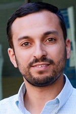
Ahmed Eldawy, associate professor of computer science and engineering
Building Open Tools for Mapping the World

Maps do much more than give us driving directions. They also help cities plan, scientists analyze, and emergency teams respond. But large-scale geospatial data is often hard to access, especially for smaller organizations or individuals.
With a $298,683 NSF grant, Eldawy is creating StarMap, a free and open-source platform that makes it easier to explore and share geographic information.
StarMap builds on Eldawy’s earlier project, UCR-Star, which stores vast amounts of mapping data. The new platform will offer easy-to-use software tools, secure data-sharing features, and hands-on training through workshops, tutorials, and hackathons.
By removing technical barriers, StarMap aims to empower researchers, agencies, and citizen scientists to use mapping data in new ways—from monitoring agriculture to responding to wildfires and shaping public policy.
